Friday, December 4, 2009
Saturday, March 21, 2009
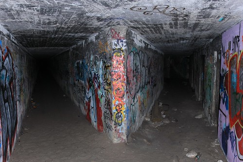
Dawes Point Battery
History
The first known building to be constructed on the site of Point Maskelyne (later renamed Dawes Point) was an observatory constructed in early 1788 by Lieutenant William Dawes.
A powder magazine was installed in 1789 followed by the Battery in 1791. The battery was constructed under the direction of George Barney, one of Australia’s most important Colonial Engineers of the mid 19th century. The site had previously been used as a cemetery for prisoners executed at Sydney Gaol (1797-c1830). The fort was expanded substantially in 1819 when Governor Lachlan Macquarie ordered convict Francis Greenway, who was an architect to design and construct a castellated fort at Dawes Point, which at the time was only meant to appear threatening to ships sailing into Sydney Harbour. In that same year sandstone blocks were quarried on site at Dawes Point Park for the construction of the fort.[2]
Dawes Point fort received many upgrades throughout the 1800’s as new threats to Britain’s empire arose. The fortification was intended to be the first line of defence in the event of an attack by the Spanish in 1790 and further threats of Napoleon’s French troops in 1810.
In 1850 during the Crimean War, there were further fears of an attack by the Russian Pacific Fleet so the battery received additional subterranean powder magazines and occupancy was taken up by Royal Artillery. In this year the Dawes Point Battery became the command post for a series of fortifications that were built around the inner harbor, which included Fort Denison.
Colonel George Barney was given the task renovating Sydney’s fortifications and an extension of Dawes Point in 1860.
Sydney’s Harbour defences had been relocated to the entrance of Port Jackson by the end of the 1800s, thus rendering Dawes Point obsolete. The battery was then used to accommodate the Commandant of the Australian Military from 1901 and 1903.
Most of the fort was demolished in 1925 to make way for the construction of the Sydney Harbour Bridge. In 1932 the remaining buildings that served as a headquarters for Dorman and Long, the British company responsible for the construction of the Sydney Harbour Bridge were demolished and the whole area landscaped and set aside for public use.
Friday, March 20, 2009
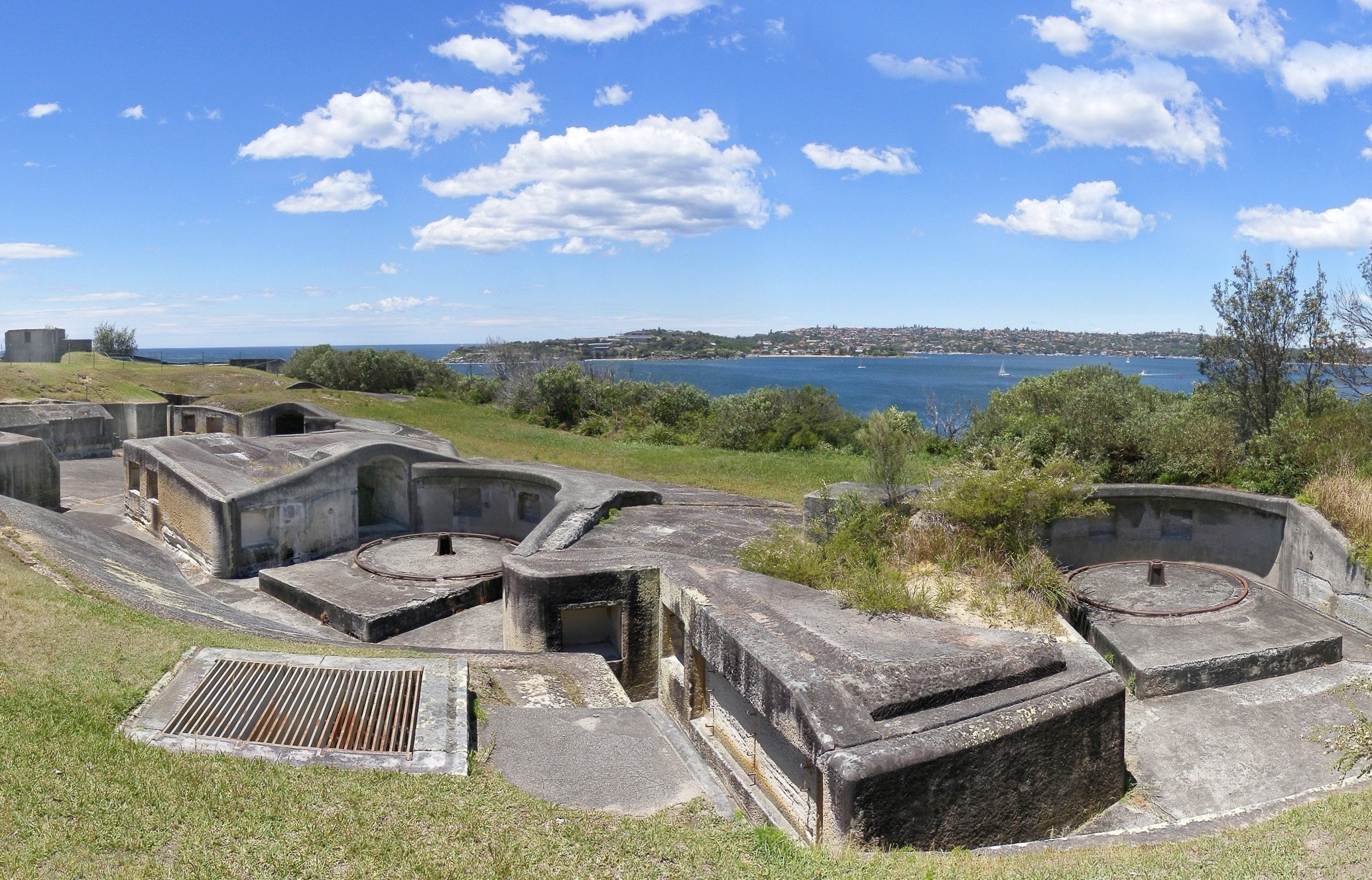
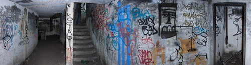
Steel Point Battery

History
The land on Shark Point was resumed from its private owners and construction of the battery began in 1871 and was completed in 1874 with an additional barracks being added in 1880. The site was designed under the supervision of colonial architect James Barnet who was responsible for designing several other harbour fortifications during this period. In 1872 three 80-pounder rifled muzzle-loading guns were installed.
In 1893 the fort was upgraded to hold a BL 9.2 inch (234 mm) Mk VI breech-loading 'counter bombardment' British Armstrong 'disappearing' gun. The Shark Point Battery was one of three such batteries protecting Sydney Harbour. The other two are the Ben Buckler Gun Battery at Bondi, and the Signal Hill Battery at Watsons Bay. The design of the batteries included a domed metal shield that covered each gun pit was intended to protect the gun from incoming shells. The Shark Point Battery's 9.2 inch gun's serial number was 7317. At some point the gun was removed and the battery converted to hold three 5-inch breech-loading guns.
The Shark Point battery formed part of the Sydney Harbour defences and was originally built at a time of fears of a Russian attack and other concerns such as in the withdrawal of British garrison troops, threats to British dependencies and increasing self reliance in defence matters. The fort worked in conjunction with various other forts located on Sydney Harbour that were also built in or around 1871. These forts included, the Middle Head Fortifications, the Georges Head Battery, the Lower Georges Heights Commanding Position and another small fort on Bradleys Head, known as the 'Bradleys Head Fortification Complex'.
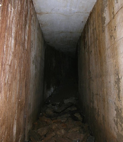
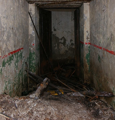
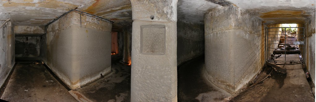
In its last form, the battery consisted of three sandstone gun emplacements or pits with embrasures for the guns to fire through. These pits were connected by open passages and covered passages that led into underground chambers that consisted of a gunpowder magazine, a shell and artillery store and two shell and lamp recesses built of stone. The site had its own living quarters that included amenities for the workers manning the fort. The fort was surrounded by a picket fence with a sandstone base and another barbed wire fence for security. The fort also had its own jetty with connecting roads.
Shark/Steel Point at present consists of a three-gun battery. The passageways, tunnels, magazine store and barrack room are now partially buried. The stone lintel cover of the entry to the rear emplacement was smashed and the tunnel filled with debris, allowing water to seep in causing damage to the interior. The stonework of the lower emplacements and connecting passages are in good condition and there is still one gun emplacement located above ground.
The land on which the fort is located was granted to the state of New South Wales in 1980 and later became the responsibility of the New South Wales National Parks and Wildlife. A small portion of the land on which the fort is located is used as a degaussing station by the Royal Australian Navy.
Bare Island (New South Wales)
Bare Island is connected by a footbridge to the suburb of La Perouse. The historic military fort and tunnels can only be visited by guided tour. The waters around the island are popular with scuba divers.
The island was featured in Mission: Impossible II.
History
Bare Island was part of the traditional land of the Gweagal and Kameygal Aboriginal tribes. In 1770, it was described as ‘a small bare island’ by early explorer, Lieutenant James Cook.
In 1877 it was decided that a fort was to be built on the island. Botany Bay was considered the back door into Sydney, thus making the city vulnerable to a seaborne attack. The construction of a fort on the island would reduced the odds of an attack from this entry point. Plans for the construction of a fort were drawn up by the Colonial Architects Department and tenders in 1880. Government tender for construction was awarded to John McLeod and Co, who also built the Georges Head and Middle Head fortifications. Construction of Bare Island fort was completed in 1885 at a cost of 34,000 pounds. Work inside the fort began in 1889. The Bare Island Fort was designed by Colonel Scratchley, the plans were prepared by Mr Morell, CE and supervised by James Barnet (1827-1904).

In 1890 a Royal Commission found that construction of the fort was faulty due to the use of an inferior grade of concrete. The whole project started to crumble before it was completed. The Royal Commission was very critical of the material used and were reluctant to refer to the material as concrete. The two clerks who were responsible for the operation, Henry Purkis and Edwin Colley, were found to be neglectful in their duties of inspecting the site. The contractor responsible was asked to repay some of the money that was paid out to him. He was also banned from any other government contracts. The Colonial Architect Mr James Barnet who is more widely known for designing many of the beautiful sandstone buildings in Sydney was eventually blamed for failing to oversee the project and to limit the amount of extra funds paid out to the contractor. This led to his resignation in disgrace from government office.

Though bristling with guns, the fort was soon made redundant by advancing technology. By 1902 Bare Island was decommissioned and ceased to exist as a military fortification, with only a handful of military personnel manning the fort. In 1912, Bare Island became a retirement home for war veterans from the Crimea, Sudan and China campaigns. It continued to operate as a retirement home until 1963, after this the Randwick District Historical Society became caretakers of the island. In 1967 it was passed onto the New South Wales Parks and Wildlife Service for use as a museum and tourist attraction. The Bare Island fort has now been declared an historical site.
Fort Denison
History
Prior to European settlement, the island had the Aboriginal name Mat-te-wan-ye (sometimes Mallee’wonya). After the first fleet arrived in 1788, Governor Phillip and his Advocate-General used the name Rock Island. In 1788 a convict named Thomas Hill was sentenced to a week on bread and water in irons there, and the island came to be known as Pinchgut. Once a 15 metre (49 ft) high sandstone rock, the island was flattened as prisoners under the command of Captain George Barney, the civil engineer for the colony, quarried it for sandstone to construct nearby Circular Quay.

By 1796 the government had installed a gibbet on Pinchgut. The first convict to be hanged from the gibbet may have been Francis Morgan. In 1793 the British transported him to New South Wales for life as punishment for a murder. The authorities in NSW executed Morgan for bashing a man to death in Sydney on 18 October 1796.
In 1839, two American warships entered the harbour at night and circled Pinchgut Island. Concern with the threat of foreign attack caused the government to review the harbour's inner defences. Barney, who had earlier reported that Sydney’s defences were inadequate, recommended that the government establish a fort on Pinchgut Island to help protect Sydney Harbour from attack by foreign vessels. Fortification of the island began in 1841 but was not completed. Construction resumed in 1855 because of fear of a Russian naval attack during the Crimean War, and was completed on 14 November 1857. The newly-built fort then took its current name from Sir William Thomas Denison, the Governor of New South Wales from 1855 to 1861.
The fortress features a distinctive Martello tower, the only one ever built in Australia and the last one ever constructed in the British Empire. Construction used 8,000 tonnes of sandstone from nearby Kurraba Point, Neutral Bay. The tower's walls are between 3.3 metres and 6.7 metres thick at the base and 2.7 metres thick at the top. However, developments in artillery rendered the fort largely obsolete by the time it was completed. The tower itself had quarters for a garrison of 24 soldiers and one officer. Fort Denison's armament included three 8-inch (200 mm) muzzle loaders in the tower, two 10-inch (25-cm) guns, one on a 360-degree traverse on the top of the tower and one in a bastion at the other end of the island, and twelve 32-pounder (15-kg) cannons in a battery between the base of the tower and the flanking bastion.
Eventually all the guns were removed, except for the three 8-inch (200 mm) muzzle loading cannons in the gun room in the tower, which were installed before construction was complete. The width of passages within the tower are too narrow to permit these to be removed. However, from the beginning the three cannons were of limited utility, for two reasons:
-
-
- The embrasures for the cannons were too small to use the guns effectively. By the time the cannon was loaded the ship would have sailed past.
- The recoil was too powerful for the small room.
-
In 1906, a saluting gun was transferred from Dawes Point to Fort Denison (see below).
In 1913 a lighthouse beacon built in Birmingham, England, and shipped to Sydney, replaced the 10-inch (25-cm) gun on the roof of the tower. In 2004 the NSW National Parks and Wildlife Service, which manages the site, restored the lighthouse beacon, which is still in use. The fort also has a still-functioning foghorn and a tide gauge room, which was established in the mid-1800s.
In May 1942, three Japanese two-man midget-submarines attacked Sydney Harbour. When the cruiser USS Chicago (CA-29) fired on the Japanese, some of its 5-inch (130 mm) shells hit Fort Denison, causing the tower minor damage that one can still see today.
Since 1992, the National Parks and Wildlife Service, which manages the site, has spent around A$2m conserving and upgrading the facilities. Origin Energy too made a significant contribution for the work.
Following publication of a Conservation Plan, further renovation commenced in 1999 and was completed in 2001. The conservation and adaptive re-use of the island was awarded the NSW Royal Australian Institute of Architects (RAIA) Conservation Award; a ‘Commendation’ in the National RAIA Awards; and a National Trust Heritage Award in 2001.
Increased harbour traffic, coupled with the rising sea levels, has already destroyed the slipway. Furthermore, the porous sandstone drinks in the salt right down to the fort's foundations. In 2007 the government announced a $1.5 million rescue package.
Current use
Fort Denison is now a museum, tourist attraction, Sydney's only island cafe, and a popular location for wedding receptions and corporate events. The tourist facility contains an exhibition of the island's history from Aboriginal times.
Access to Fort Denison for tourists is via a ferry that departs wharf 6 at Circular Quay every 45mins, 7 days a week. The price for the ferry ticket includes guided tours of the island, including the Martello Tower. NSW National Parks & Wildlife Services conducts the tours, and also operates a Harbour Navigational Facility, with tide gauge, navigation channel markers, foghorn and beacon. The Bureau of Meteorology operates a weather facility from the island and publishes observations at half hourly intervals on their website

Fort Denison in Sydney Harbour. Photo credit Andy Mitchell (Amitch) Creative Commons Attribution ShareAlike 2.5
At 1pm every day, Fort Denison's staff fire a cannon. This practice began in 1906 to enable sailors to set their ship's chronometers correctly. The daily gun continued until World War II when the authorities stopped it for fear of alarming residents. The practice recommenced in 1986.
Famous prank
Further information: Fort Denison incident
In 1900, as the Boer war raged in Africa, the White Star Line ship Medic sailed into Sydney Harbour and dropped anchor in Neutral Bay. One evening, the fourth officer, Charles Lightoller and four midshipmen rowed to Fort Denison and climbed the tower with a plan to fool locals into believing a Boer raiding party was attacking Sydney. They hoisted a makeshift Boer flag on the lightning conductor and fired one of the cannons located at the fort.
The conservative citizens of Sydney frowned upon this activity and after an investigation Lightoller accepted sole responsibility for the incident and was reprimanded. White Star Lines apologised and paid damages to the city.
Charles Lightoller went on to be the second officer of the RMS Titanic and the most senior officer to survive the 1912 sinking of the ship. He was a key witness at both the British and American inquiries into the disaster.
Sydney Harbour defences
Sydney's earliest fortifications were built around Sydney Cove to protect the new colony of Sydney from attacks from non-British ships or convict uprisings. The first gun emplacement was built in 1801 on Middle Head (north of Obelisk Bay) during the Napoleonic wars. More permanent fortifications were built during the first half of the 1800s in response to feared foreign attacks and new threats to the British empire. In 1790 the Dawes Point Battery was meant to be the first line of defence against an attack by the Spanish Empire, Napoleon’s French troops in 1810, and the Russian Pacific Fleet in the 1850s (during the Crimean War). This was part of a line of defences that were concentrated on protecting the inner Harbour, these also appear to have been given a low priority. Construction of Fort Denison began in 1841, though the fort wasn't completed until 1857.
Sydney's defences were expanded following the withdrawal (Cardwell reforms) of British soldiers from Australia during the 1870s. This prompted the construction of four sets of fortifications on Georges Heights and around other parts of the harbour, the Middle Head Fortifications, the Georges Head Battery, the Lower Georges Heights Commanding Position and a smaller fort located on Bradleys Head were constructed during this period and upgraded in the 1880s on the advise of British experts. They were designed to attack enemy ships as they attempted entry into Sydney Harbour. Some of these forts, were at the time, built of an out dated design.

A Submarine Miners’ Depot was constructed at Chowder Bay (Georges Head) in the 1880s. In 1888 the site was modified for the latest in harbour defences. The site was a strategic position and considered the best place to observe and fire mines which were laid underwater. Minefields were laid across the main shipping channels of Port Jackson from 1876 to 1922 and a base was built at Chowder Bay for the submarine miners (Clifton Gardens). From Georges Head, miners watched for ships entering the harbour. Their job was to explode the mine closest to an approaching enemy ship. Each underwater mine was attached to an electric cable that ran up the cliff to the firing post.
The work of the submarine miner was secretive, technical and dangerous. During a demonstration in 1891, a crowd of several thousand watched as a terrible accident killed four miners and injured another eight. The Submarine Mining Corps was dismantled in 1922.
Sydney's defences were expanded over the last decades of the 19th century and eventually incorporated a fort on Bare Island to defend the approaches to Botany Bay.
World War II
Sydney's defences were not expanded from their pre-Federation condition until the 1920s. During the 1920s a number of well-constructed fortifications were built to protect Sydney. Sydney's defences were further expanded following the outbreak of World War II and were considerably augmented once Japan entered the war. While Sydney's anti-submarine defences were not yet complete at the time of the attack on Sydney Harbour on the night of 31 May 1942, they were successful in sinking two of the three Japanese midget submarines which attempted to enter the Harbour.
The end of coastal defence
Following the end of the Japanese threat to Australia Sydney's defences were reduced from 1944. The last fortifications were not decommissioned until the 1960s, however. While Sydney is no longer protected by fixed defences, a high proportion of the Australian Defence Force is based within the greater Sydney region and could be called on to protect the city during an emergency. During the 2000 Sydney Olympics security for the Harbour was provided by Special Forces, Navy Clearance Divers and warships.
Current major ADF facilities in Sydney include:
- Air Force
- RAAF Base Richmond
- Army
- Holsworthy Barracks
- Navy
- HMAS Kuttabul
- HMAS Penguin
Fort Macquarie


History
A half moon battery on the east point of Bennelong Point was constructed in May 1798 when the ship HMS Supply was withdrawn from service, Lieutenant William Kent and crew were assigned to man the battery. The battery consisted of some of the guns taken from HMS Supply.
Governor Lachlan Macquarie directed that a fort was built between December 1817 to February 1821 under the direction of Francis Greenway. The fort was named after Governor Lachlan Macquarie was a square fort with circular bastions at each corner and a castellated square tower.
The battery consisted of fifteen pieces of ordnance: ten 24-pounders and five 6-pounders. Three sides of the fort abutted Sydney Harbour.
The two-storey tower in the middle of the fort, housed a guardroom and storehouse. The tower was 27.4m (90 ft) in circumference. A powder magazine capable of storing 350 barrels of gunpowder was constructed underneath and the tower could provide accommodation for a small military detachment of 1 officer and 18 men, with stores for the battery.
A drawbridge, on the landward side, over a small channel leading to a gate beneath the tower provided entry to the fort.
Fort Macquarie was demolished in 1901 to make way for new electric tramway sheds named Fort Macquarie Tram Depot.
Cannon Disposal
Two 42 pdr ML cannon from Fort Macquarie were removed from the fort and transported to Newcastle in 1903 to form a memorial in Gregson Park, Hamilton. In 2006 they underwent a refurbishment and have been replaced back into Gregson Park.
Thursday, March 19, 2009
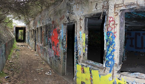
Bradleys Head Fortification Complex
The Bradleys Head Fortification Complex is a small fort located on the northern side of Taronga Park Zoo that formed part of a total defence system for Sydney Harbour and recalls a period when the colony of New South Wales became increasingly aware of its isolation and wealth. The fortification is located on Bradleys Head Road, Mosman, Australia.


History
Construction of the fort began in 1840-42 and consisted of a gun pit and firing wall that was built out of large blocks of sandstone and carved partly from the original rock that was located on site. The earlier stages of construction during this period were done with the supervision of Major George Barney, a Commanding Royal Engineer who used hired labour that was supplied by Governor Gipps.
In 1871 the fortification received an additional barracks. The barracks were constructed from large sandstone blocks and carved out of the existing rock on the headland. The 1871 barracks were designed and constructed under the direction of James Barnet, a colonial architect. This most recent addition consisted of three gun pits and had connecting galleries for the riflemen. The upgrade of 1871 was complementary to some of the larger fortifications being constructed during the same period on Middle Head, South Head, Georges Heights and Georges Head.
The site is now part of the Sydney Harbour Federation Trust.
 The only entrance to the battery constructed in 1871. |  A feature inside the onsite barracks. |  One of the barrack hallways with an entry point to the innermost chamber on the right hand side. |  The innermost chamber of the barracks |
 Trenches leading to gun emplacements and into the underground chambers on site. |  Large gun emplacement constructed 1840-42 |  Cannon and gun emplacement constructed 1871 |  Empty gun emplacement constructed 1871 |
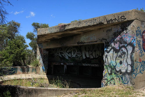
Fort Banks (Australia)
Fort Banks (Eastern Command Fixed Defences) is an old World War II bunker and fortification complex that was used to protect the approaches to Botany Bay. The fortification is located north of Cape Banks in La Perouse, New South Wales Australia.


History
Prior to WWII a portion of the land located on Cape Banks that belongs to the New South Wales Golf Club was utilized by the Australian Defence Forces for the construction of the Cape Banks Battery. This was part of the Sydney Coastal Defences built prior to & during WW2. The counter bombardment fortifications consisted of two breech loading 9.2 inch gun emplacements, underground plotting room, underground powder & shell magazine, hydraulic pump room, & some short tunnels linking the different sections. During this period the Henry Head Battery which was built much earlier was also re-utilized and consisted of two breech loading 6 inch guns.
 A partially buried gun emplacement that formed part of Fort Banks |  Inside one of the bunkers |
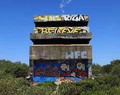
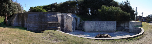
Malabar Battery
Malabar Battery was a coastal defence battery built in 1943 during World War II at Malabar Headland, Malabar, New South Wales, Australia. The battery is also known as Boora Point Battery.
Four story observation post forming part of the Malabar Battery (below)
The battery was constructed to complement the existing coastal defence batteries at nearby Henry Battery, Banks Battery and Bare Island Fort.
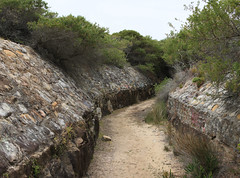
Two 6 inch Mark XII guns in gun emplacements on mountings were constructed at the battery. An underground counter bombardment facility, with gun crew ready rooms, ammunition supply and engine room together with a narrow-gauge tramway which was cut into the sandstone and lined with sandstone and a large battery observation post were also constructed at the battery.
The tramway was a single track of 560mm (22in) and was to transport the 6" projectile munitions to the shell expense stores/magazines in the base of each gun emplacement. The tramway traverses through a deep continuous cutting lined with sandstone leads from the ammunition drop off point to the basement of the ammunition supply room and up to the two gun emplacements. Before reaching the gun emplacments the line enters a rectangular section concrete tunnel which is 94m (310ft) long.
Also constructed as part of the battery were northern and southern searchlight blockhouses with associated engine rooms and the battery barracks and toilet blocks.
Following decommissioning of the gun emplacements after the war, the site fell into disrepair.
Wednesday, March 18, 2009
Drummond Battery
Drummond Battery was a counter bombardment battery at Port Kembla, Australia during World War II.

No. 2 BL 9.2 inch gun in 1944


Constructed in 1942 to provide protection for Port Kembla from enemy shipping and submarines. Two BL 9.2 inch Mk X gun emplacements with related underground facilities were constructed near Drummond, Wollongong.
Today the site is used as a mushroom farm. I was told that if you are polite with the owners they will let you in to have a look.
Sydney Harbour anti-submarine boom net
The anti-submarine boom net was an anti-torpedo and submarine defence net that was in Sydney Harbour during World War II. It spanned the entire width of the harbour from Green Point, Watsons Bay to Georges Head, on the northern side of Sydney Harbour.[1] The boom formed part of the Sydney Harbour defences which also included artillery batteries and patrol boats.

The British aircraft carrier HMS Formidable passing through the anti-submarine boom in Port Jackson (Sydney Harbour) in 1945
History
Construction of the boom commenced in January 1942 and the boom and gates were fully operational by August 1942. For over three years, entry to Sydney Harbour was restricted by the boom net. All vessels including ships, ferries and fishing boats gained access to the harbour via one of three gates in the anti-torpedo and anti–submarine boom which spanned the harbour from Green Point to Georges Head.
On the night of 31 May 1942, three Japanese midget submarines attempted to enter the harbour in what became known as the Attack on Sydney Harbour. On the night of the attack the central section of the net was complete and support piles were in place to the west, but there were gaps of up to 400 metres (1,300 ft) wide on either side of the boom net. Material shortages, not lack of interest, prevented the completion of the boom net prior to the attack. The first submarine, the M 27, commanded by Lieutenant Jahai Chuma was the first submarine to attempt entry. The M 27 followed another vessel in the harbour, but at some stage became entangled in the western end of the boom net's central section. Lieutenant Chuma tried to free his submarine by using a sawtooth metal cutter which only entangled it further. By 8.30 pm he had attracted the attention of the watchman for the Maritime Service Board, James Cargill. He rowed across in a boat and discovered the Japanese submarine. Surprised, Cargill radioed naval headquarters. It took him two hours to convince the navy that there was a Japanese Midget submarine caught in the boom net.
At 10:27 pm Chuma, realising that he had been detected, detonated charges, destroying the submarine whilst killing himself and his crew in the process. The two other midget submarines penetrated the then only partially completed boom net, and attacked shipping for several hours before being destroyed.

Entrance to Green Point Anti-motor
torpedo boat defensive Battery.
The boom net was removed after the end of the war in August 1945, and by early 1946, everything apart from the dolphins had been removed. The foundations of the winch house are the only remaining evidence of the anti-submarine boom net and they can still be seen on the shores of Green Point, along with other remaining evidence of military installations, such as underground fortifications and bunker complexes.
Adjacent to the winch house stood a stone marker that had existed for 90 years prior to the boom net's construction. Erected in 1850, this was used as a navigational leading mark for the Eastern Channel; it was lined up with the back mark which still stands on the west side of Parsley Bay.

Boom gates
The western gate was usually kept shut and was only opened for very large vessels that were damaged or under tow, which required the use of the deeper and straighter Western Channel. The western gate was opened by a tug boat. All other ships used the eastern gate, which was controlled by the boom gate vessel. The gate was opened by dragging it back to the hauling-back dolphin using winches housed on Green Point. The small craft gate was lowered to a depth of 5 metres (16 ft) with a winch mounted on board HMAS Kuramia.
Dimensions
The boom was 1,480 metres (4,855 ft) long, with two gate openings for ships. The gate on the Western Channel was 121 metres (397 ft) in length and was used for larger vessels. The gate on the eastern side of the channel (Eastern Channel) was 91 metres (299 ft) long, and there was another gate for smaller boats located on the western side of the boom gate vessel (tug boat), which was 30 metres (98 ft) long. The vessel used to pull theses gates open was the HMAS Kuramia, a converted Sydney Harbour ferry, that had been used for public transportation from 1914. The central and western sections of the boom consisted of some 49 clusters of four piles with the net, which was made of wire and interlocking steel rings about 450 mm (18 in) in diameter, suspended between them. The eastern, Green Point, section of the net was suspended from buoys, as were the eastern and western gate nets.
Signal Hill Battery
The Signal Hill Battery was constructed in 1892-3 at Watsons Bay and is adjacent to the Signal Hill Lighthouse on Old South Head Road. The Battery was one of a set of three coastal defense fortifications in Sydney, Australia, the other two being the Ben Buckler Gun Battery at Bondi, and the Steel Point Battery in Vaucluse. Each battery consisted of a gun pit that incorporated a BL 9.2 inch (234 mm) Mk VI breech-loading 'counter bombardment' British Armstrong 'disappearing' gun.
Pictured is the above portion of the fortification. This is one of two on this site.
The Australian government bought nine such guns and an extra barrel. The Signal Hill gun bore Serial Number 7318 and its barrel survives on public display at the Royal Australian Artillery Museum at North Fort, North Head.
This tunnel lies below ground and once led out to Old South Head Road
heading in direction of Gap Park.
These fortifications were the last link in Sydney’s outer defense perimeter, which was intended to defend Sydney from bombardment by an enemy vessel standing off the coast.
This tunnel is also part of the underground bunker
The fortifications built in the 1890's around Sydney's eastern suburbs were the culmination of some twenty years of construction of harbor defense installations that reflected the changing policy of the time to meet new technologies, threats and styles of warfare.
Above ground gun emplacement
The 9.2 inch (234 mm) breech loading gun was fired for the last time in 1933. It was removed and replaced in 1937 by two 6 inch (152 mm) Mk XI guns placed in each of two outer gun emplacements; these guns were removed after WWII. The fortification also has an underground complex that runs beneath Old South Head Road. It contains a maze of rooms and corridors including a mess room, elevator shaft and gunpowder magazines.
Ladder leading into the underground bunker
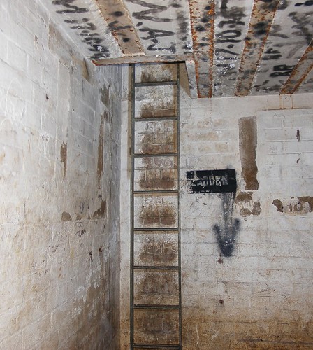
The entrance from the street has been tack welded and sealed. A memorial was placed there in November, 1992 by the Royal Australian Signal Corps Association on behalf of its members and two plaques were also placed on March 30, 1993 placing the reserve in proper historical perspective.
This tunnel is also part of the underground bunker
The fortifications built in the 1890's around Sydney's eastern suburbs were the culmination of some twenty years of construction of harbor defense installations that reflected the changing policy of the time to meet new technologies, threats and styles of warfare.
Above ground gun emplacement
The 9.2 inch (234 mm) breech loading gun was fired for the last time in 1933. It was removed and replaced in 1937 by two 6 inch (152 mm) Mk XI guns placed in each of two outer gun emplacements; these guns were removed after WWII. The fortification also has an underground complex that runs beneath Old South Head Road. It contains a maze of rooms and corridors including a mess room, elevator shaft and gunpowder magazines.
Ladder leading into the underground bunker
The entrance from the street has been tack welded and sealed. A memorial was placed there in November, 1992 by the Royal Australian Signal Corps Association on behalf of its members and two plaques were also placed on March 30, 1993 placing the reserve in proper historical perspective.
Georges Head Battery
The Georges Head Battery is located on Georges Head, in the suburb of Mosman in Sydney, New South Wales, Australia. The Georges Head battery is one of three forts in the area that were built for the purpose of defending the outer harbor. The fort became a command post in the 1890s for the coordination of all of Sydney's harbour defences.


Georges Head Battery was an outer line harbor defense fortification designed especially to attack and prevent enemy ships from infiltrating the inner harbor. The fort held a prominent position and was located high above sea level with strategic views to the entrance (Sydney Heads) of Port Jackson. Other batteries were located on Middle Head, South Head, Shark Point and Bradleys Head, but none were ever used for combative purposes.

Georges Head was armed with four 80 pounder rifled muzzle loading guns and two 68 pounder muzzle-loading guns. It took three months and 250 soldiers to roll the gun barrels all the way from North Sydney to the batteries. They came along a rough track which later became Military Road. The guns had been positioned so poorly that this created the risk of one gun firing upon another. Also, the guns and soldiers were visible from the harbor. In 1877 large mounds of earth were placed between the pits to make sure the guns could not fire upon each other and to help protect the gun crew from enemy fire. When construction of the fort was complete, there were a total of 41 gun emplacements positioned around the harbor.

Defence tactics were planned using telescopes and plotters mounted in the middle of the second gun pit. From the telephone exchange, the Port Jackson District Commandant could communicate with all military installations on the harbor. Telephone cables ran through the tunnels, down the cliff and under the harbor to batteries on the other side.

The work of the submarine miner was secretive, technical and dangerous. During a demonstration in 1891, a crowd of several thousand watched as a terrible accident killed four miners and injured another eight.
World War II
In 1942, during the Second World War, the 'Sydney Harbour anti-submarine boom net' was installed. The boom net spanned the entire width of Sydney Harbour from Green (Laings) Point, Watsons Bay to Georges Heights in Mosman
The command post remained until the 1930’s. The area then became home to various defense bases until 2002 when the Army left after 130 years at Georges Head. The area in which the fortifications are situated is now open to the public and the Harbour Trust has restored the historic fortifications, creating a new type of lookout.
Casualty clearing station & storage facility
The hospital was carved out of solid rock during the construction of the tunnel system in 1872, and was originally designed to provide a storage room for the black powder charge used when firing the 68pdr and 80pdr guns of the battery.

The floor was originally covered in a bituminous substance, the walls were tiled with ceramic tiles not unlike those seen on the wall pictured, and the tunnel ceiling leading to the room was lined with cork. The purpose of these measures was to reduce the possibility of sparks and the potential for a powder explosion. The zigzag tunnel at the far end of the room was designed to act as a blast wall to contain any blast within the immediate area.
The room has been modified since 1872 and was used as a casualty clearing station in 1932/33 when the battery was re-gunned with the 6 inch breech loaded MK7 guns. Designed for emergencies only, it fortunately saw no casualties of war.Middle Head Fortifications
History
The site on which the fortifications are built includes all of the fortifications that were built between 1870 and 1911. The site contains the works of several periods and technologies that still exist to this date. Historically it dates from a time when defence was first moved away from Sydney Cove and towards The Heads.
There were three sets of fortifications built in Mosman, New South Wales and Middle Head in the 1870s, these were upgraded in the 1880s on the advice of British experts. These fortifications still exist and are now heritage listed, they are, the Lower Georges Heights Commanding Position, the Georges Head Battery and a smaller fort located on Bradleys Head, known as the Bradleys Head Fortification Complex.
The first battery on Middle Head was built in 1871 and was designed by James Barnet, a colonial architect. The fort was built on a strategic location and received many additions until 1911. It formed part of a network of 'outer harbour' defences. They were designed to fire at enemy ships as they entempted entry through the Sydney Heads. The whole area is linked by an extensive network of underground tunnels, ancillary rooms, gunpowder magazine and a disappearing gun emplacement. The site also has its own underground power room that is supported by iron columns. The gunners Barracks were built from sandstone quarried on site and still exist to this day, they are located on Middle Head concealed in bushland. Underground tunnels and rooms were used to train some of Australia's first troops that were sent to Vietnam in 'Code of Conduct' courses (lessons in how to withstand torture and interrogation) by simulating prisoner of war conditions.
In 1974 the Middle Head fortifications featured in the movie Stone.

In 1979 most of the area became national park and the military has moved on to more strategic locations. The army base on site which included the transport group and 30 Terminal Squadron, left Georges Height's in 1997. The Headquarters Training Command section relocated to the Victoria Barracks in 2002.
The Officers QuartersThe Officers quarters is a Victorian Regency style building that was built on a rough stone base. It was designed by Colonial Architect James Barnet and is considered to be one of the most significant buildings at Middle Head. The site incorporates a defensive ditch or moat and includes a fortification wall. The house looking in the direction of Middle Harbour meant that it could be used for surveillance purposes as well.

One former resident was Major General Sir William Throsby Bridges KCB CMG, the first commander of the Australian Imperial Force and the commander of Australian forces at Gallipoli. Throsby Bridges was killed by a sniper whilst leading the forces at Gallipoli. His warhorse Sandy was brought back to Australia, seeing out its days in Victoria.
Primarily used as a residence this building originally housed two officers separately, a senior and junior officer.
During World War II this building served as a Red Cross Hospital and later as accommodation for the Australian Women’s Army Service. The house continues to be used as a residence.
Subscribe to:
Posts (Atom)